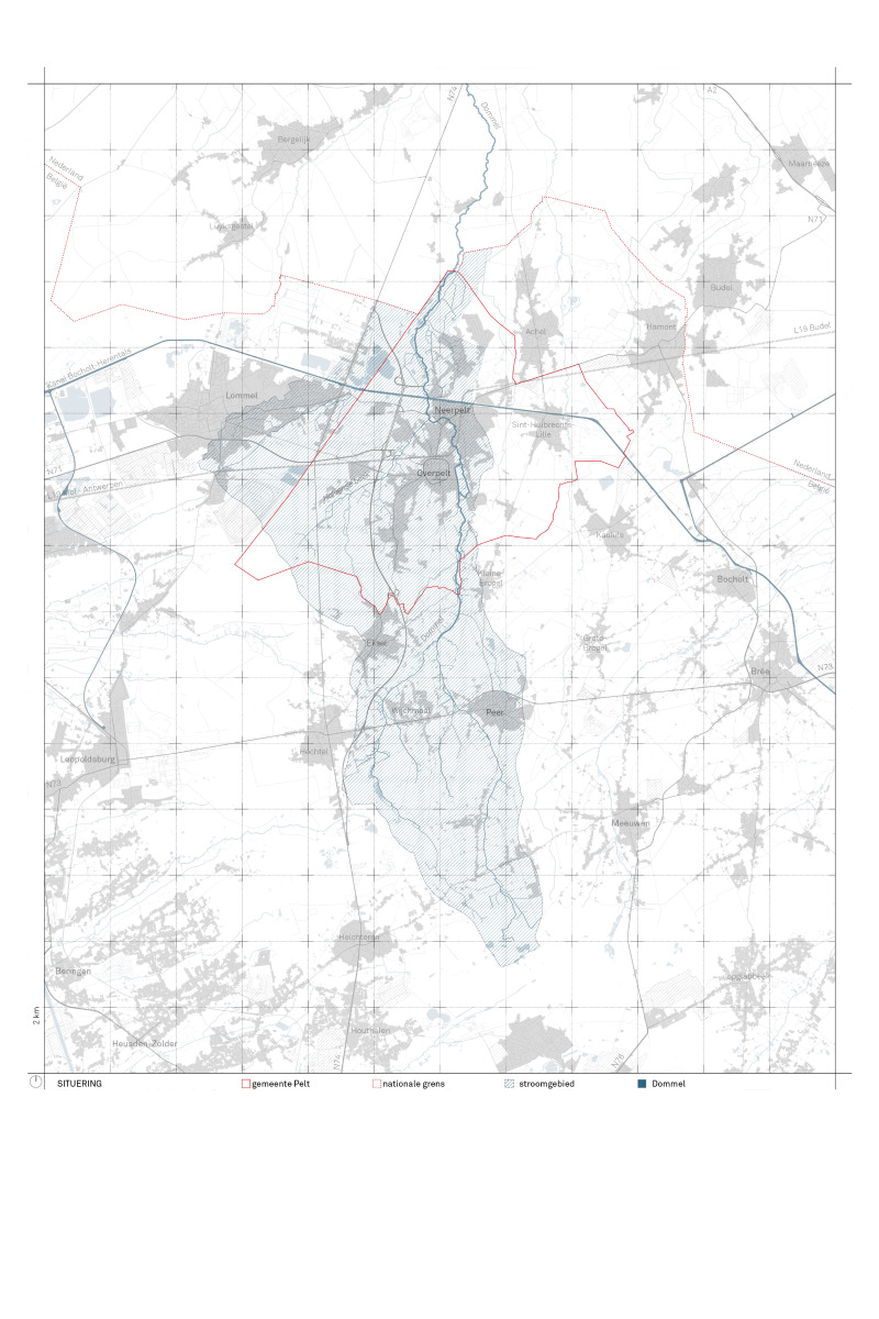
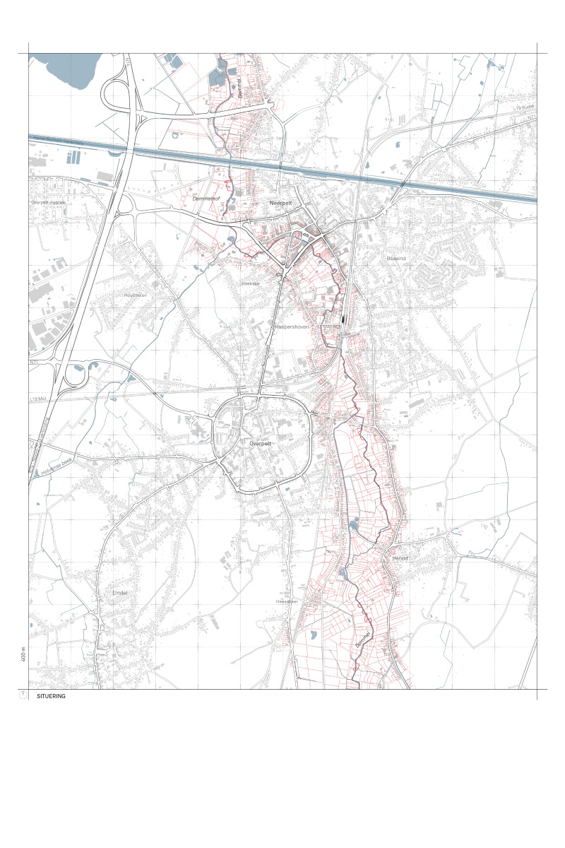
Due to the merger of Overpelt and Neerpelt into the common municipality of Pelt, the Dommel valley no longer forms the border between two municipalities but rather the green heart of the new merged municipality.
The VMM, the water manager of the Dommel, and the municipality of Pelt are both clients for this project. In the past, the left bank was in the municipality of Overpelt and the right bank in the municipality of Neerpelt. The merger into the municipality of Pelt has created the opportunity to approach the valley comprehensively for the first time in spatial policy.
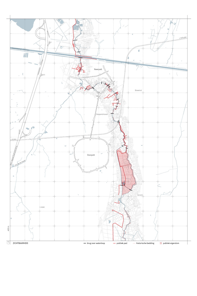
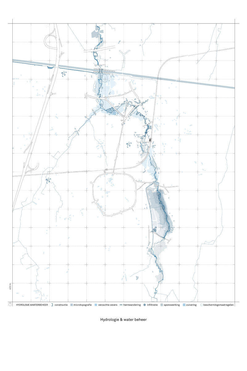
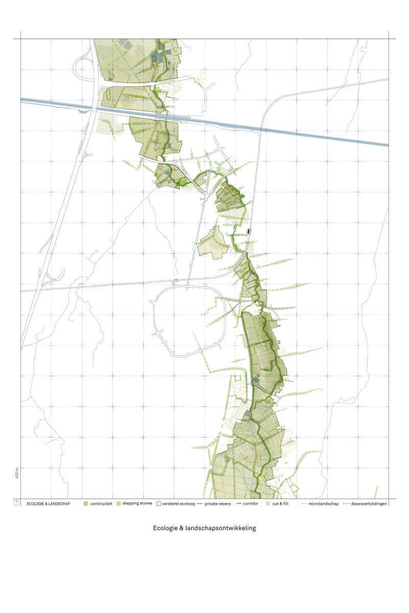
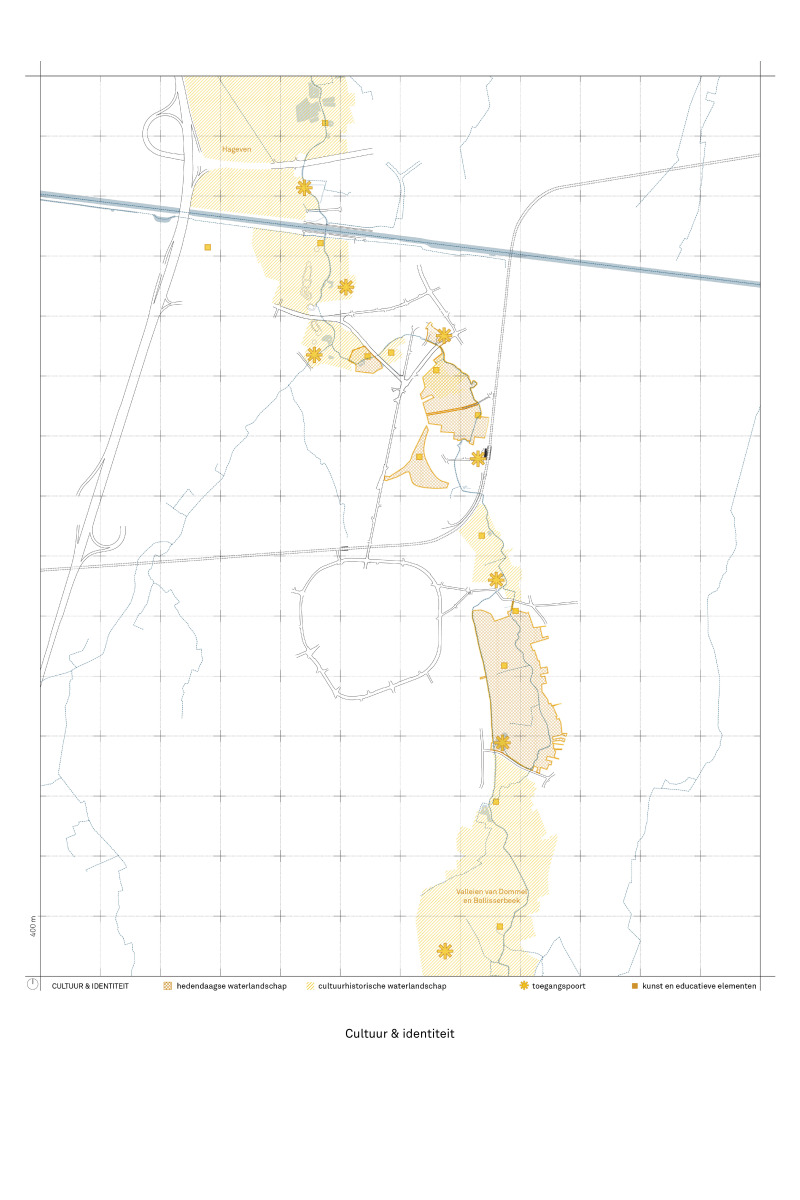
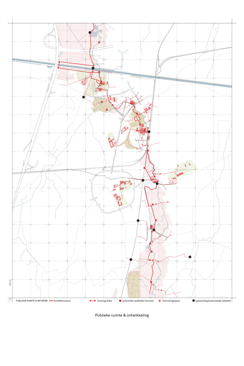
The objective of this study is to anchor the Dommel valley in the heart of the municipality of Pelt. Several themes were simultaneously examined in the study ; hydrology and water management, ecology and landscape development, culture and identity, public space and development, and planning context and legal tools.
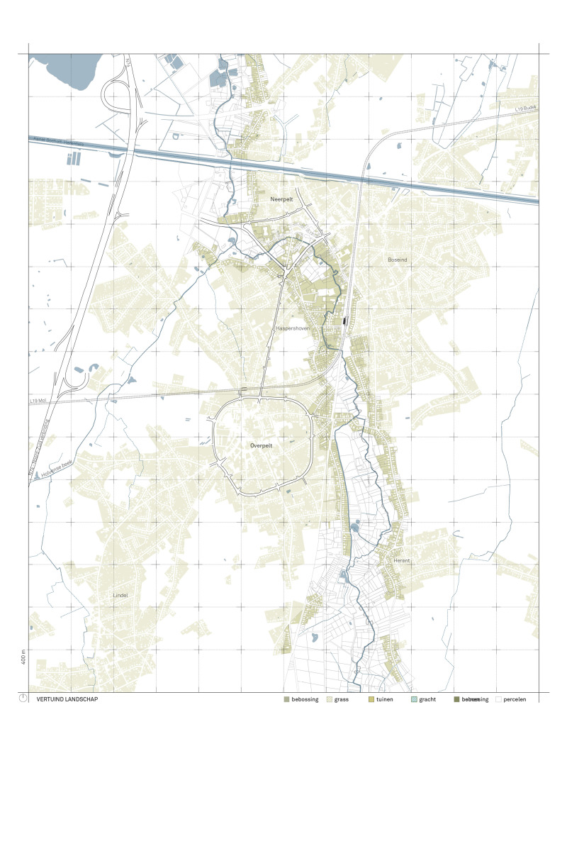
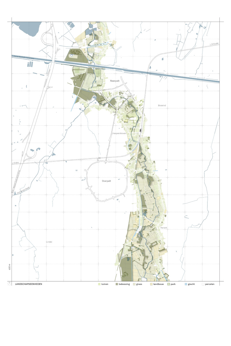
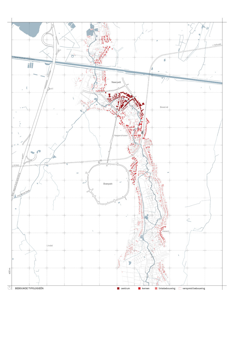
To shape this new approach thoroughly, it was chosen to apply an in-depth analysis. Detailed analyses were made around the five main themes, which were compiled in an analysis atlas. Cartographically, the Dommel valley is central, automatically creating a new perspective on this valley. By combining the different layers of analysis, challenges and opportunities emerge that can feed into the vision design.
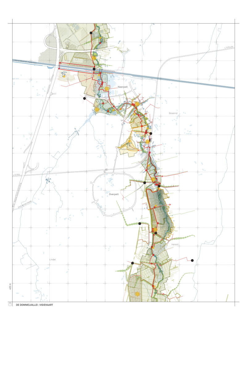
Through design research, in collaboration with all stakeholders, generic solutions were sought in the form of a toolbox. These spatial interventions, formulated for each theme, were synthesized into thematic vision maps. These vision maps depict the broad potential of the Dommel valley as: a cool recreational space in the summer, a green connection for slow mobilities, a climate-resilient landscape, a water buffer during heavy rainfall, and a meeting space tailored to Pelt.
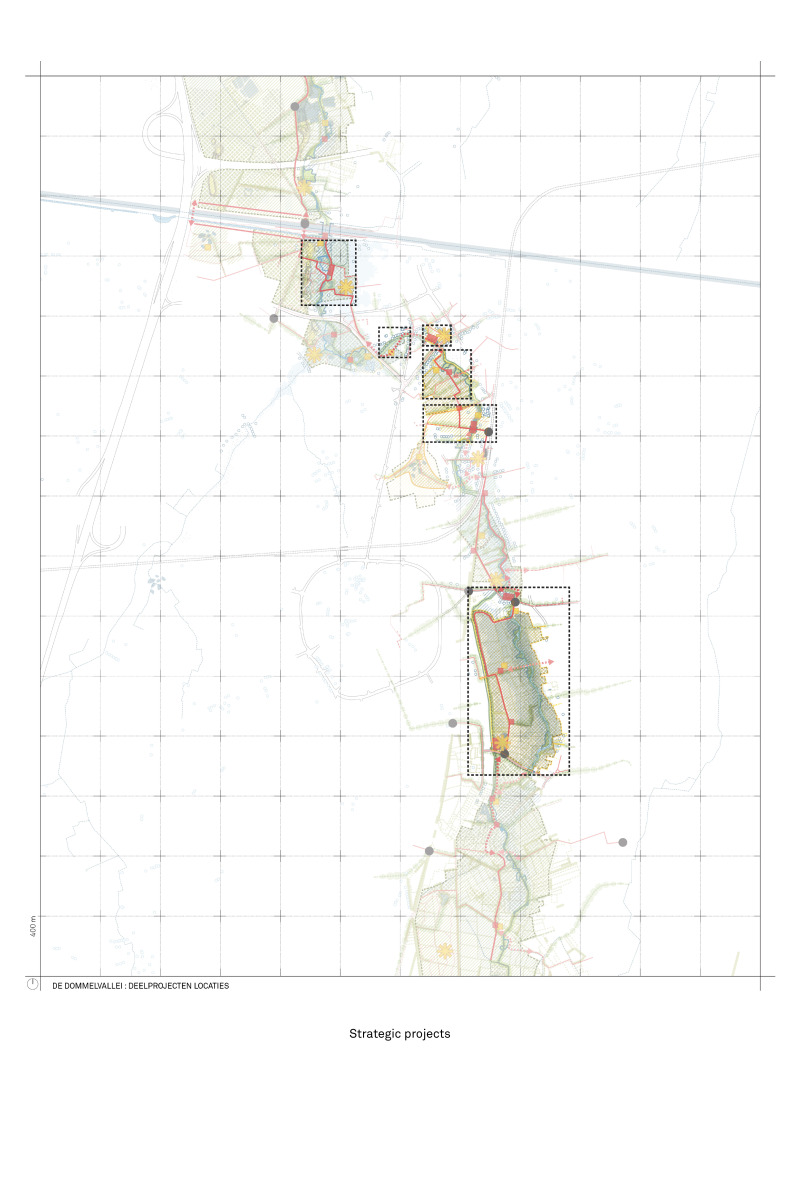
A number of strategic locations in the Dommel Valley have been further developed in this study. The chosen locations are where various themes from the study converge. For each sub-zone, project sheets have been prepared describing concrete (sub)steps for the implementation of the development plans. Throughout the process, broad support has been obtained from all stakeholders for the implementation of these spatial interventions.
The participation process took place during various lockdowns of the coronavirus pandemic. Together with the municipality of Pelt, a walk was laid out through the study area, allowing people to undertake it at their own pace and in their safe bubble. An online GPX route was made available, along which information panels were set up at 7 locations. In addition to providing information, these panels provided the opportunity to give input via a QR code. By making the walk available during the Christmas break, a large response was obtained, which was used as input in the further development of the various sub-zones of the project.